March 31, 2009

24 Karat Kids

K is for krazy kids.
Kids are keen on knavery. They'll stop a mom's heart with kinetic energy and kamikaze moves.
such as pretending to fall into the Kolorado River

Or acting like they're about to keel over a kliff,

They'll put on enough bandaids to make you think they're kaput,

So, what's a mom to do? Send them back to kindergarten?
Knuckle their knobs with a knock?
Is it possible to turn their kinetic knavery to kaleidoscopic knowledge?
I never knew.
The key may be in learning to keep your sites on those times when they're just so kute you have to kiss them.


(My 3 are grown now, kind, knowledgable and knice. Perhaps kissing was the key, after all.)
For more kernels of K words, click here.

Cliffside Granary

From Monument Point, where the Grand Canyon trek ended, Steve and company drove to an old campsite of ours and hiked to a Native American granary that we've seen before.
Can you spot it?

The granary is built into a pinnacle standing all by itself near the canyon rim. A climb is required to reach it. Probably it was placed in this out of the way place to have a food supply well hidden from enemies.

The guys found the granary unchanged from our last visit, although deterioration is obviously occurring over time. What was once an adobe-like covering has worn away in places, showing the wooden framework beneath. One of the stones leaned up against the bottom of the opening may have been used to seal it.
If you enlarge and look carefully at the photo (below) of the floor inside the granary, you can see a couple of corncobs remaining from the Native Americans' centuries-old cache.

March 30, 2009

Canyon Connoisseurs


Steve just returned from a Spring Break hike in Grand Canyon National Park with our son Eric and Chris, Eric's friend from Denmark. March is early for hiking from the North Rim, but with snow pack 60% of normal, they were able to reach Monument Point, a great place to begin a trek into the canyon.

The trail looks almost like a sidewalk where slickrock is exposed, but in many places, the trail markings are slim to none.
Here, a cairn (on the left) marks the way.

Potholes on the esplanade (a flat section below the first cliffy descent) held enough water for pumping a fresh supply for a lunch break. Here, Eric and Steve pose with mushroom-shaped rocks.
Manzanita and this cactus were in bloom.

And this barrel cactus is impressive.
At Deer Creek Spring, water flows out of a limestone cave and falls at least a hundred feet to the ground. During maximum spring runoff, the volume would be greater.

The two young guys raced down to the Colorado River, while Steve rested up at camp. Stars that night were incredible.
The next day, they hiked back to the esplanade, where Eric and Chris took a side trip to Thunder Spring. I don't have Eric's photos from this trip yet, so here are some photos I scanned from May, 1999. Thunder Spring also emerges from the cliffs. What appear to be green bushes in the background are actually 100 foot tall cottonwood trees, to provide some perspective.

Here you can better appreciate the powerful cascades during spring runoff.

Steve and our sons (with my daughter and I tagging along on a few occasions) have hiked into the Grand Canyon by many routes, many times over the last 15 years. We have developed a special love and appreciation for this wild, stark country's unique beauty.
For view into other fascinating worlds, click here.

March 28, 2009

King of the Road


In Yellowstone National Park, when does a 2000 pound American bison cross the road? Any time he wants to!
In fact, he's free to walk down the center stripe for miles if he so chooses and traffic must defer to him.
In Yellowstone, bison and other wildlife always have the right of way. Isn't it grand, giving the wild creatures a chance to rule for a change?
For more Camera Critters, click here.
This post was named a "top contender" for David Mcmahon's Post of the Day.
Thank you, David!

March 26, 2009

Prince's Plume


Prince's plume, also called desert plume
(Stanleya pinnata) of the mustard family grows up to 4 feet tall, often in selenium-rich soils.
This is a perennial herb. Both seeds and plant were used by Native Americans.
Steve took this photo in Canyonlands in May, 2002.
To see more skies from around the world, click here.

March 25, 2009

Jumpin' Jehosaphat!

J is for
jumping juveniles,

Jabbering and jawboning,

Junior jesters,

And the juxtaposition of joyful journeys in January and June.


For more from Denise Nesbitt's ABC Wednesday, click here.

March 23, 2009

Salt Creek


Salt Creek is in the southern portion of Canyonlands National Park, and is the only perennial water source for miles around. Therefore, it has been a natural choice for Native American habitation for millenia.

Until 1998, vehicular traffic was allowed along and beside the creekbed in the middle fork of Salt Creek, but because of environmental damage caused by the traffic (sometimes up to 100 vehicles per day), the area was closed to all but hiker or horseback traffic. This ruling was contested by the Utah county where the creek is located and by 4 wheel drive organizations, but the final decision has been to keep vehicles out of the area.
We visited by foot several times between 1999 and 2002.
Angel Arch, one of the best known arches in Utah, is located about 8 miles from the trailhead.

All American Man is one of many Fremont pictographs found near the creek.
It is located in an alcove above the ruins of a dwelling and dates to 1250 BC. Apparently it was painted on top of rock art that is at least 1000 years older. You can see what appear to be handprints around the figure.
Here is what I call the "Smiley Face" pictograph, my favorite.

I can just imagine a youngster painting this above his home, including the entire family in his drawing.
On one trip, we were caught in a thunderstorm late in the day and sought shelter in a large overhang in the Rincon area. It even had a handy rock shelf for cooking.
The next morning's light revealed an ancient pictograph that had stood guard above our sleeping bags. This appears to be of the Barrier design, probably up 3000 to 5000 years old. We haven't seen this rock art described anywhere. Because we found it almost by accident, not many people may know it's there. I call this one "Batman". If you enlarge and look carefully, you'll see a design to Batman's left, and other areas with red pigment that may be what is left of additional ancient art.

To see other worlds, click here.

March 21, 2009

Tabby Mountain


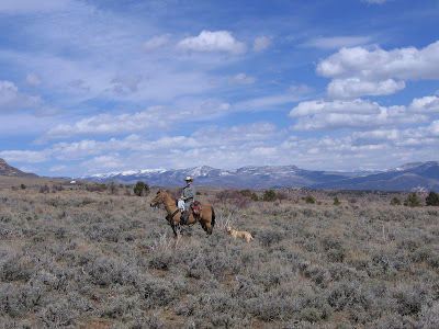
Tabby Mountain WMA (wildlife management area) northwest of Duchesne, Utah is over 40,000 acres where vehicles aren't allowed from December to May. This limits disturbance of big game on winter range. The area is fenced and locked, with only a few openings made for horses and riders to enter.
We last went there on December 1 (see Moonlight Ride), when we had quite an extended adventure and ended up returning to the truck with the dubious aid of a crescent moon.
Our trailhead today was at 6800 feet. We cantered about 5 miles along game trails and two tracks until we reached this spring. The water was still frozen in the center of the pool.
This cabin near another small spring is about to collapse. I gingerly stood on what was left of the porch while Mischief considered whether the structure offered any goodies for him.
At 8300 feet elevation, we ran into large patches of snow and saw a herd of 20-30 elk. They didn't hang around long enough to be photographed, but Steve and Boss were willing subjects.
Daisy didn't make much effort to track the elk since she was pretty tired already. Instead, she stretched out in the snow to cool off.

At various places along the ride, deer went bounding away from us. We saw a dozen or more, total. And a rabbit crossed right in front of Mischief's feet. The bunny quite craftily waited until Daisy was past so he could make a run for the dense brush. Daisy never saw him. She followed the bunny trail a short distance, but was quickly distracted by all the deer scent.
The scenery was great, the temperature was in the 60's, and the sun was out at least some of the time. It was easy to believe spring has sprung.
Good thing we went today, because tomorrow there's an 80% chance of snow!

We rode 12 miles with 1800 feet elevation gain and loss in 2 and a half hours. I think we're all feeling a little worked this evening.

March 19, 2009

The Canvas of Yellowstone


The northwest corner of Yellowstone National Park is beautiful rolling grasslands and an immense sky. This photo was taken in June, 2007, on the Rescue Creek trail. I'm the hiker, and Steve is the photographer.
For more Skywatch photos from all over the world, click here.

LinkWithin

Blog Widget by LinkWithin