Showing posts with label Corner Canyon. Show all posts

May 8, 2018

Corner Canyon

There are several Corner Canyon trailheads within a few miles of our house.  We go there for a training ride along upper Corner Canyon road, about 12 miles and 2400 feet of elevation gain.
You can see the "road" above. It's rutted and rocky in places and would be challenging for a 4 wheeler.  We've never seen a vehicle up there, although we usually see bikers and sometimes hikers.
At first the horses were scared of bikes, but they have adapted to a more urban environment and all that goes with trails near the city.
At the upper end of our ride, we looked out across the mountain vista and saw some white dots. 
With the camera zoom, a small herd of mountain goats became visible.  
Closer still, and you can see the goat's horns.
Salsa is sporting her new saddle as she looks out over the scenery.
Behind Steve and Salsa is the 11000 ft Box Elder Peak, still snow-covered down to about 9000 feet.

February 7, 2018

Spring in February?


2500 feet above our trailhead in Corner Canyon
Even though I haven't been posting, we haven't stopped riding.  We rode in the neighborhood and in Dimple Dell through most of the winter.  Steve has a new horse, Salsa, shown above. Salsa is wearing Easyboot Gloves, which are like running boots for a horse.
Mt. Timpanogas in the background
For the past couple of weeks, we've been riding Corner Canyon, gradually increasing our altitude as the snow melts.  As of today, the trails are snow-free up to 6900 feet on the southwest facing slopes.  That allows us to make a 12 mile round trip with a total altitude gain and loss of about 2500 feet.  A fine workout!


Utah Lake in background
It has been a great winter for riding😊, but maybe not so great for skiing. 😕

June 6, 2015

New Home, New Trails

We've been busy exploring the many trails available in the Salt Lake Valley.
A favorite is the trail shown in blue on google earth.  The steep part is Cherry Canyon, which begins at the Orson Smith trailhead.  The lower portion is the Bonneville Shoreline Trail, which continues south for many miles.
Cherry Canyon gains about 4000 feet of altitude in 4 miles, going all the way up the mountain to the base of Lone Peak.
It's a fantastic ride with great views of the mountains and the Salt Lake valley.
In the panorama above, you can see Utah Lake on the right, and the Wasatch Mountains on the left.
We stopped when we reached snow, at about 9100 feet.  The stream shown above comes from melting snow.
The water was clear and cold, just the way a thirsty horse likes it.
Flowers are blooming on the mountain.  A bank of orange poppies attracted out attention.
Near the trailhead, the grass is tall from all the rain we had in May.
Since we've been city folk, the horses have learned to tolerate walkers, joggers, hikers with backpacks, bikers, and an assortment of dogs.
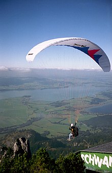
One morning, as we traveled up the Cherry Creek trail, a dozen paragliders swooped down the mountain and passed about 10 feet over our heads.  Boss got a little freaky over that, but he got over it when he found that the big sails and whoo-whooing adventurers were not going to eat him. (The photo above came from Wikipedia.  We were way too busy keeping the horses from running down the mountain to take any photos of the actual event.

LinkWithin

Blog Widget by LinkWithin