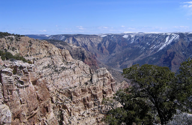
Split Mountain is located within Dinosaur National Monument near Vernal, Utah. We ride to the top (about 7600 feet) at least once every year.
Google Earth provides a view of our trail (in blue). As you can see, the mountain is split by the Green River passing through.
The photo above, taken from the top, looks down on the river as it passes through the split.
We ran into snow patches in the Ponderosa pine forest that starts a few hundred feet from the summit. We forged ahead.
To the northwest, the Uintas loomed.
The view to the northeast looks down on the meandering path of the Green River after it passes through the mountain and into the Uinta Basin.
Here's a panorama of the scene to the east, looking toward the mountains of Colorado.
We had a great ride, about 14 miles with 2700 feet of elevation gain and loss, completed in about 2.5 hours of working time. We were moving fast, but the horses are in great condition and didn't seem to mind. Daisy had to stay home, poor girl. No dogs are allowed in the Monument.


I briefly considered revisiting the monument last month but it was too cold and we headed back south. Thanks for teasing me with the beautiful photos. I liked the Google Earth view you included. Gives us a real idea of where you traveled.
ReplyDeleteAw, poor Daisy. Looks like she missed out on a fantastic trip. Those are some gorgeous views.
ReplyDeleteAbsolutely breath-taking views! My be just amazing to do it by horseback.
ReplyDeleteI'm glad we could go with you, even if Daisy couldn't. Split Mountain is a fascinating place, and the views are spectacular. Thanks for the Google Earth view.
ReplyDeleteI am always in awe of the magnificent scenery shown in your photos Janie. What a gorgeous part of the world you live in.
ReplyDeleteWhat magnificent views!
ReplyDeleteWhat a magnificent sight for my old eyes! Thanks for the wonder-filled view that I would never otherwise see, Janie.
ReplyDeleteHappy trails, be well,
Pam
Those views are simply amazing. So geological.
ReplyDeleteBeautiful views, Janie. The snow shows that it's still fairly cool at the higher altitudes. I guess the horses don't mind climbing as the air gets thinner...or do you have to slow down as you go higher?
ReplyDeleteAnother amazing adventure. Too bad Daisy couldn't make it. You need to explain that Daisy is not just any dog, she has a large following on the internet.
ReplyDeleteHopefully, Daisy does not know what she was missing. The views are outstanding!
ReplyDeleteabsolutely awesome....
ReplyDeleteDogs are allowed in our swamp preserve, but only on a lease. Great coverage on the map. Did you download your GPS coordinates directly into Google Earth? - And was it difficult?
ReplyDeleteWhat a magnificent view, it take my breath away.
ReplyDeleteAmazing photos! I still need to go there.
ReplyDeleteWow! I've never seen it from the top. It looks like a very steep hike without four legged assistance.
ReplyDeleteAmazing views, gorgeous photos! I especially love the pine trees.
ReplyDeleteThose are some killer views! And I agree, poor lil Daisy, I bet she cried.
ReplyDeletehow intersting--I love the perspective. My family ran the green from Gates of Ladore down to Jensen in 1977. Split Mountain was very impressive from the river. I'll share your post with my siblings. They'll like this view as well.
ReplyDelete