 (this map is from the journal of Fray Silvestre Velez de Escalante)
The Dominguez-Escalante expedition traveled through eastern Utah in 1776, roughly following the path of today's Hwy 40. On our rides, we've taken note of many of the creeks and springs that this group of Spanish padres recorded. (Escalante was the scribe for the trip, and has since had his name attached to a Utah river, town, and national monument. Dominguez, the expedition leader, has his name attached to nothing, strangely enough. The moral of the story: it pays to be the one who records history, because the scribe shall inherit the names.)
.JPG) A Ute Indian guide led the expedition through one of the Utes' favorite hunting grounds, a beautiful valley that has since been dammed into what is now known as Strawberry Reservoir. At the time, a river ran through the valley, but there was no lake. Escalante named the series of green meadows Valle de la Purisima, translated as Valley of the Purest, or Valley of the Virgin. Too bad we'll never see those meadows because modern man's lust for water has taken it over. (The 3.5 mile Strawberry Tunnel, 7 feet in diameter, penetrates through the mountains to bring this water to the Wasatch Front - Salt Lake City and surrounding areas.)
A Ute Indian guide led the expedition through one of the Utes' favorite hunting grounds, a beautiful valley that has since been dammed into what is now known as Strawberry Reservoir. At the time, a river ran through the valley, but there was no lake. Escalante named the series of green meadows Valle de la Purisima, translated as Valley of the Purest, or Valley of the Virgin. Too bad we'll never see those meadows because modern man's lust for water has taken it over. (The 3.5 mile Strawberry Tunnel, 7 feet in diameter, penetrates through the mountains to bring this water to the Wasatch Front - Salt Lake City and surrounding areas.)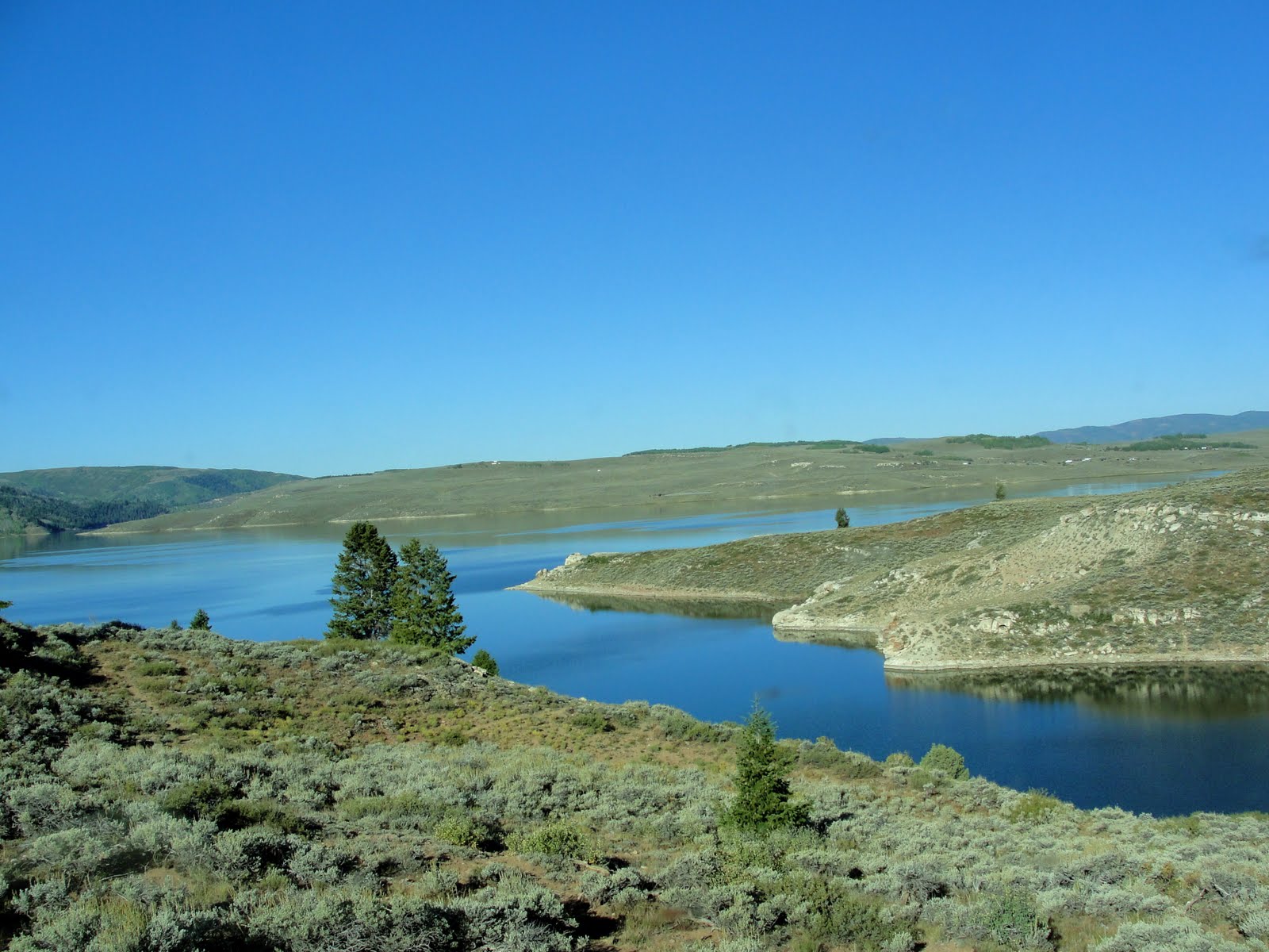 The land around the reservoir is still beautiful and relatively untouched.
  Game still abounds.
  On our trip to the area two days ago, some of the aspen had changed.
 Next post, I'll tell you about our ride: the fishing, the horses, the sheep.
Hey, what's up with this sign?
 This sign is located at the Soldier Creek Dam turnoff, and an identical sign points toward the Aspen Grove Campground. (An internet search indicates Forty Dam Acres is a community, but it's not shown on any map. Guess we'll have to follow the signs sometime and see what we find.)
Old maps are so interesting. I really admire pioneers for their courage and the hardships they faced as well as the danger.
ReplyDeleteI wonder if an N has been missed off the Forty Dam Acres and maybe an E and a D ;-)
Hi Janie, It's so neat to read and follow history... Funny story about the scribe getting all of the attention!!!!
ReplyDeleteSo much changes when they dam areas.... When TVA (power) built lots of dams in TN--many people lost their land and homes... It was very hard for someone whose family had had that land for years and years.
Great pictures. I love seeing the golden Aspens.
Hugs,
Betsy
Oh--and you all need to check out Forty Dam Acres..... Keep us posted!!!!
beautiful photos Janie..and great information...
ReplyDeleteI enjoy learning the history of an area. Looks like a grand landscape to ride through - those mule deer sure have big ears.
ReplyDeleteThere has to be a story behind the name of that community. I hope you can find out something about it and share with us.
ReplyDeleteThanks for the history/geography lesson. When I was in school the lessons were never accompanied by such wonderful pictures.
Not only do we get to travel with you into this beautiful country but I love the added history and geography. I'm with Escalante getting the credit.
ReplyDeleteGreat post. The trees are slowly changing. It seems like Sept 20 is the key date in these high mountains.
ReplyDeleteHave a great weekend.
The golden Aspens are beautiful and the history was quite interesting.
ReplyDeleteMan just can't seem to learn that nature know best and to leave it alone.
strawberry reservior is a beautiful place. It was fun to learn a little of its history. Thanks.
ReplyDeleteBeautiful shots, as always and nice info too.
ReplyDeleteJanie: Love your neat capture of your Utah area of the USA.
ReplyDeleteInteresting name for the reservoir, and you have me wondering about that river and those meadows.
ReplyDeleteHilariouws sign.
ReplyDeleteAbsolutely stunning pictures!
ReplyDelete