December 9, 2010

Antelope and Deer

Have you ever seen an antelope wearing a radio collar and sporting a red ear tag?
We never had until we spotted this guy in Nine Mile Canyon.
We also saw a herd of deer grazing in a meadow.  They seemed as tame as cows.  Cliffs and castle rocks loomed behind them:
We'll be taking a blogging break to spend time with family for the next couple of weeks. 
Happy holidays to all of you! 

December 7, 2010

Steve's Sidewalk

The search for petroglyphs can be precarious. 
Literally.  The cliff to Steve's right (above) is about 100 feet straight down.
He calls this ledge a "sidewalk". 
I wasn't nearly as relaxed about walking on it.
I wish the Native Americans of old (probably of the Fremont culture in this area) hadn't liked heights so much.  They often built their homes in cliffy spots.  Here are the ruins of a 1000 year old pit house, situated at least a couple of hundred feet above the Nine Mile Valley floor:
Their choice was logical, though.  The height gave them a good view in all accessible directions.  If enemies attacked, the pit house dwellers would have had plenty of warning. 
Up above the old dwelling, the petroglyphs were amazing. Pecking all of these figures into stone must have taken a lot of time:
Seems like somebody was having a bad hair day:
Parent and child, holding hands?:
This cliff on the other side of the valley is said to have ruins on the summit, and probably some petroglyphs, also:
Should we get out our climbing gear?  Does anyone have a helicopter?

December 3, 2010

The Wild West

Today, Nine Mile Canyon is famous for its many impressive panels of ancient rock art, but in the 1880's, the canyon was best known for being on the supply route from the Price, Utah train station to the Uinta Basin (by way of Gate Canyon). 
Although Native American trails undoubtedly existed in the canyon for at least 1000 years, the army built the first formal wagon road to bring supplies to Fort Duchesne, a military installation opened in 1886 to "control" the Utes who had recently been moved to a reservation in the Uinta Basin area.
The ghost of a military presence remains in this old structure with the US Army sign still hanging at the entrance:
Beside it is a building that housed a telegraph office, first open for business beginning in 1887:
A stagecoach traveled through the canyon on a twice weekly, and later a daily route.  Here's a photo of an old saloon/watering hole that still stands:
There is no door, so perhaps the "open" sign was redundant.  One can imagine thirsty stagecoach travelers and freight wagon drivers stopping by for a drink.
An old lodging house leans drunkenly next door,
Antique farming equipment decorates the grounds:
The old saloon and lodging house were built on the William Brock Ranch. Brock was one of the first ranchers to settle in Nine Mile, but his ranching days ended when he killed a man and had to hotfoot it out of the country.  A man named Pete Francis took over the saloon, but he didn't last long, either.  He was killed in a brawl in his own saloon.  In 1902, Francis's widow sold the property to Preston Nutter, who made the Nine Mile Canyon ranch his home as well as the headquarters for his extensive cattle operations all over Utah, Colorado, and Arizona. 
Here's a photo of Preston Nutter (on the right, riding a mule):
You can read more about him here: http://historytogo.utah.gov/utah_chapters/pioneers_and_cowboys/presonnuttermadeutahhomeofhiscattlekingdom.html
The ranch remained in the Nutter family until the '60's and is still known as the Preston Nutter Ranch.
Stories abound of outlaws such as Butch Cassidy traveling through Nine Mile Canyon on their way from Robber's Roost in southern Utah, to Brown's Park, a favorite outlaw hangout in NE Utah near the borders of Wyoming and Colorado. 
So, in addition to viewing great Fremont/Anasazi rock art, you can revisit the old wild west during your trip to Nine Mile Canyon.

December 1, 2010

Rock Art for the Ages

Nine Mile Creek begins as a trickle running off of the West Tavaputs Plateau and travels through a deep canyon to the Green River.  The canyon is known for its amazing quantity and variation of ancient Native American rock art. 
The group who lived here from 800 AD to about 1200 AD produced art that has elements of both Fremont and Anasazi styles.  They lived in pit houses on the valley floor, or sometimes in rock  dwellings on the cliffs, raised corn and squash, and hunted for deer, elk, and bighorn sheep.  This petroglyph shows hunters with bows and arrows, and perhaps tells the story of a hunt:
One of my favorite sites, known as the Sandhill Crane panel, shows a pair of water birds at the top:
We toured the section of Nine Mile beginning at the junction with Gate Canyon and going toward Argyle Canyon.  In 3 hours of scouting with binoculars, climbing the cliffy hillsides for better views,  and taking photos of the numerous petroglyphs and occasional pictographs on many rock panels, we only managed to cover 3.5 miles. 
Do you see a Mardi Gras mask here?
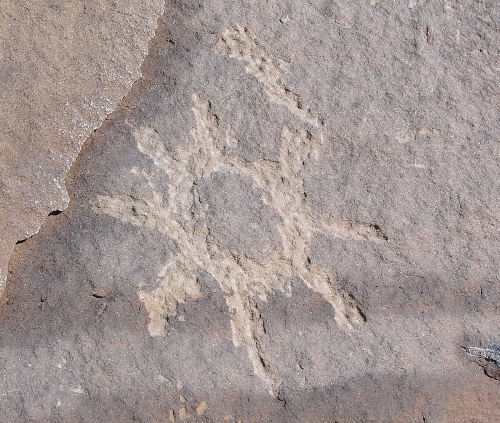
The tree-like figure above is thought to represent a corn plant.
This guy has seriously cool headgear:
Were the ancients into matrix math?
This elk has quite a rack:
I like the sunburst:
Did space aliens visit this culture?
Paradoxically, Nine Mile Canyon twists and turns for more than 50 miles on its way to the Green River.  The name Nine Mile seems to have come from the John Wesley Powell Expeditions, 1868-1871, possibly given to the canyon because of the 9 miles between it and Desolation Canyon.  There are other theories on the name, but none that make as much sense.
Nine Mile Canyon can be reached via the Nine Mile Canyon road from Wellington, Utah, or via the Wells Draw Road from Duchesne, Utah. 

LinkWithin

Blog Widget by LinkWithin