October 31, 2010

Boone Spring

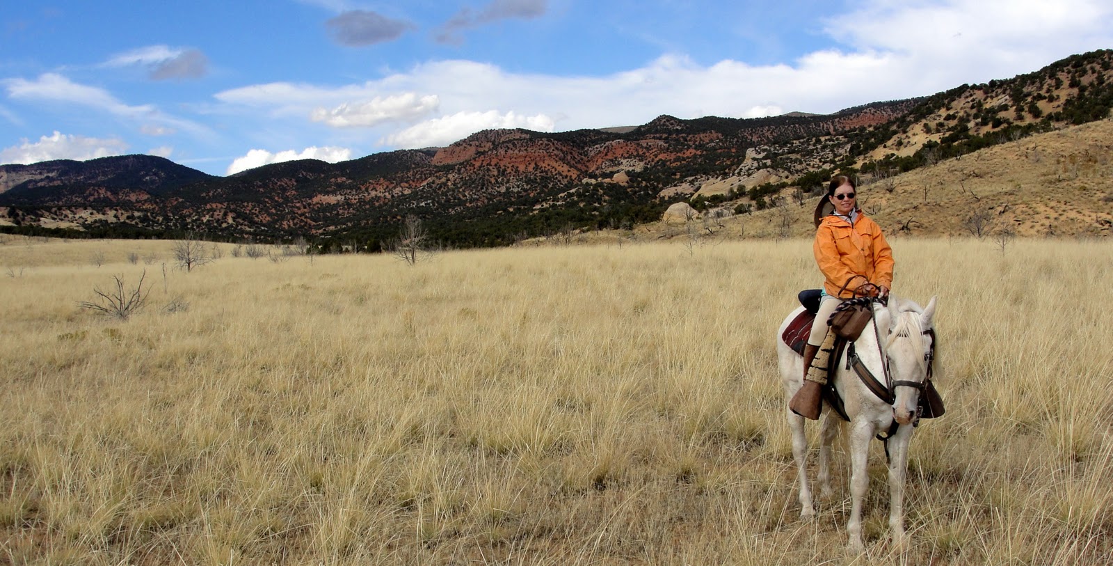
Sometimes more than one ride is required to find the perfect route, and such was the case with our transit to the top of Boone Ridge and on to Boone Spring. 
As you can see, our "trail" went around and through some rugged country:
Last trip, we never made it to the spring because we ran into a cliff band, had to resort to Plan B, then ran out of time.  
This time, we tried a different route and also ran into a cliff band.  We found a way around it, but while we were leading Boss and Coco over hill and dale, Coco escaped and ran off for a couple of hundred yards. That provided some excitement. 
He was easily recaptured, and the rest of our journey went more or less according to plan. (I won't say which plan.  Not A or B.) 
The area is remote and a bit desolate, so we were surprised to find that hunters had been there at some time in the past, leaving behind what looked like 2 deer skulls with the horns sawed off:
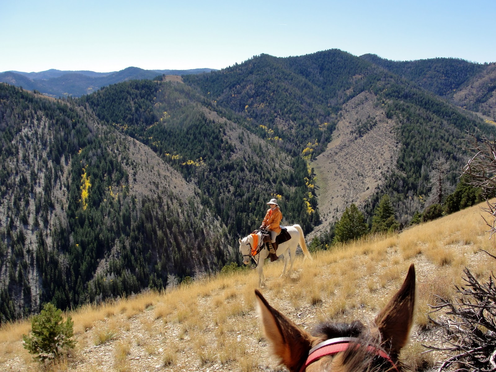
We even saw a small herd of elk along the way. If you enlarge the photo, maybe you can see them, too:
Yes, we made it to the spring:
This fenced off area is probably where Boone Spring originates, although no water comes to the surface there:
Springs are often enclosed, I assume to prevent cows from trampling the water source.  In this case, someone must have tapped into the water flow below ground and directed it into this tank: 
Boone Springs is at just under 7000 feet, a little low for much snow accumulation at this time of year. The day was cool, but that didn't stop Daisy from taking a dip in the tank, which also provided the horses with a drink.
All the animals were refreshed for the ride back:
Upon our return, the sun shone on the limestone cliffs on the south side of the Green River: 
I doubt we'll be exploring that side unless we can teach the horses to use technical climbing gear!

October 29, 2010

Something Wintry This Way Comes

The dark and light contrast on the Wasatch Mountains warned of inclement weather last Sunday, but some of us still enjoyed looking up:
The next day brought alternating drizzle and sun. The mountains sported a confectioner's sugar dusting on top, yet the Salt Lake Valley remained green:
By Wednesday morning, we had snow! 

October 28, 2010

Padre Pass

After some study on where the Dominguez-Escalante Expedition crossed Strawberry Ridge in 1776, Steve thinks he's found the spot.  Although the pass is unnamed, he has dubbed it Padre Pass, labeled in green in the photo above. Padres Dominguez and Escalante were making their way from the valley that is now covered by Strawberry Reservoir (they called it Valle de Purisima) through the Wasatch Mountains to Utah Lake.  They were the first non-native Americans known to venture through the area. 
We were drenched in orange, since it was the last day of elk season. 
These hunters watching from a ridge weren't likely to find any game, since any intelligent elk was surely in hiding, and any not-so-intelligent elk were probably goners already.
We found bright yellow Scouler's Willow growing on a ridge:
Boss found some grass.
Our trail wound through aspen groves:
past this Douglas fir twisted by the west wind:
To enjoy an expanse of fall color spread out below:
All of this goes to show that following in the footsteps of history can be fun. 

October 27, 2010

Sign or Target?

Yes, hunting season in Utah continues.  No, the above bullet-riddled object is not a deer, elk or antelope. Perhaps someone mistook it for a road target.

October 23, 2010

Baby in Bell's

The sky looked cloudy last Sunday afternoon, but we defied the chance of raindrops and drove to the mouth of the Wasatch front's Little Cottonwood Canyon for a hike up Bell's Canyon.
Mom and Dad stuffed the little darlin' in her carrier:
And Grandpa amused her with a little hide and seek: 
From the beginning, the hike had lovely views:
Maples provided vivid splashes of color:
The trail follows a small stream:
And offers impressive views of sheer granite cliffs: 
The cliffs in the Cottonwood Canyons are popular with climbers.  The climbing walls have names such as Extreme Unction, Route of All Evil, and Demon's Dance. 
The little family posed on a tree-lined trail scattered with autumn leaves:
The sky cleared by the time we returned to the trailhead.  No rain on our parade!

October 21, 2010

Family Circle

We spent last weekend in Salt Lake City and enjoyed a couple of hikes in the Wasatch Range.  The above photo was taken from the White Pine trail in Big Cottonwood canyon.  Through the opening in the canyon, you can see Salt Lake Valley spread out below. 
The aspens and maples were still providing a free fall show: 
A camera perched on a backpack and set with a timer provided this group photo:
The highlight was spending time with this young family:
The littlest hiker was soon overwhelmed by the excitement: 
We didn't mind.  She's cute when she's asleep.

October 18, 2010

Reaching the Benchmark

We've ridden to Grayhead Peak (9500 feet - shown above) before, but we've never ridden the ridges over to Grayhead benchmark, about 50 feet higher and 2.5 miles to the northeast as the crow flies.  
This time, we follow faint game trails over hill and dale, literally, to reach the benchmark. Mischief and I head uphill in the photo above. If you enlarge, you should be able to see the arrows I've used to show our "trail."
Below is a view of the trail from Google Earth:
We keep going up:
And up:
Until we finally reach the top, catching up with Steve, Boss, and Daisy:
Daisy is traveling with us again, now that she's made a complete recovery from being stepped on a couple of weeks ago. 
Since there were no creeks or springs on this ride, I rigged a drinking bowl and gave her some of my water.  The horses can wait longer between drinks.  Even though they went a total of 14 miles and 3800 feet elevation gain and loss, they did fine without water. 
Here is the benchmark:
Boards and nails indicate a fallen structure next to the benchmark:
We guess that it is the remains of a platform or tripod for a heliograph, a communication device featuring a mirror for simple Morse Code type messages.  A heliograph may have been used by USGS surveyors long ago when the benchmark was placed, or perhaps by the Forest Service for communication between rangers. 
Here's a 180 degree panorama of the view from Grayhead benchmark (click to enlarge):
On our way down, we stop on one of the remote ridges.  There is no trail whatsoever, but we happen to spy this forest service sign almost obscured by a tree branch:
Up close, it indicates the way to a canyon, but who would ever see this sign? 
Not many people travel off trail, as we do.  I doubt anyone else has seen the sign, or found their way to Wilbur Canyon, in quite a few years.  Hmm, maybe we should go there on our next ride...

October 16, 2010

Try, Try Again

We spent the night just outside Dinosaur National Monument, and mounted up early the next day. 
Island Park and Split Mountain Canyon provided our view to the south as we started out.
Our route involved descending into Garden Creek Valley.  We had a little problem, though, because our map had 40 foot contour intervals, which could involve a gentle slope of 40 feet, or a cliff.  In this case, there was a 40 foot cliff band we hadn't expected. 
You can't really see the cliff band in this photo, but we couldn't safely go that way.
Oh, well.  If at first you get cliffed out, go to Plan B.
We returned to the two track we'd started on, and found another route. 
We saw hoodoos:
And more hoodoos:
Interesting sandstone formations:
Some crazy crossbedding:
Pretty red hills and native bunch grass meadows:
At the end of the day, Mr. Crow gave his caw of approval:

LinkWithin

Blog Widget by LinkWithin