Pages

July 31, 2008

A Day in the Life... of a Farmer

This morning’s pickings:
The squash plants are huge. The green beans are just starting to produce. The corn and tomatoes have yet to ripen. We’re rich in fresh fruit. (I just recently read that all this stuff is really fruit, not veggies. The apple trees are likewise loaded. We will eat be eating well for a long time.
I remember when I was a little girl and visited my grandmother, she was always snapping beans or cooking okra or shucking corn. The garden kept her busy. She and my grandpa were retired by then, but for many years they ran a dairy farm that provided milk to many in the New Orleans area. Steve’s dad talks about how his parents lived off their acreage in Arkansas when he was a kid, growing every fruit and vegetable they could, plus keeping a few hogs for meat. Steve and my parents didn’t do much gardening, but I guess we’ve now gone full circle. All we need are some pigs.


And maybe Old Bossy.

With the FDA doing so little to inspect our food, more and more folks may be going back to old times, eating out of their own back yard garden.

July 30, 2008

Strawberry River Walk

This morning, we had planned to leave on a 2 day horse trip up the Yellowstone River drainage, but we decided to take a walk down the Strawberry River instead. Unfortunately, due to the sudden change in plans, we forgot the camera. Therefore, all photos shown here were swiped off the internet.
We began below the Soldier Creek Dam. The trailhead there has a Bear Country sign, and it indeed looks like great black bear country. On a walk there years ago, we saw bear scat on the trail. Today, we didn’t see any bear sign.
Ripe black berries loaded the twinberry bushes along the trail. Wax currants had ripe red burries. Chokecherry bushes were loaded, but the fruit is not yet ripe. Many wild roses grow along the trail, but their bloom, and that of the numerous cliffrose bushes, was past. Penstemon, leggy Indian Paintbrush, and some globemallow still bloomed. The plant life is a mix of desert and riparian zone, with sage, gambol oak, a few junipers, and Douglas fir growing down to the stream along with sedge, berry plants and lush grass.
There were lots of tall red thistle blooming beside the trail, with bees busily working over the blossoms.
Of course, the reason for being there was fish. We saw quite a few large cutthroats in the pools created by beaver dams, but they proved hard to catch. Steve counted coup on four of them, dry fly, catch and release. He didn't have much luck fishing with a grasshopper pattern. Did best with a homemade black ant.
We strolled about 2 miles down the stream. Daisy had a great time in the water, and even did pretty well at staying out of the casting zone when given the “back” command.
Tomorrow, on to the Yellowstone, we hope.

July 27, 2008

B.F.F. (Best Friends Forever)

Wanna be friends? A bond in the making... A Brokeback Moment:Sweet nothings:
My man and his dog: My guy and his horse:


July 26, 2008

Show or Field?

When we were looking for a yellow lab pup, we researched the breed and found that show stock dogs are better for family, more sedate, etc. Books advise that the field trial variety have too much energy for the average household.
Therefore, we asked the breeder which type her litter was. The breeder, of course, having read the same advice to buyers that we read, told us that our Daisy’s litter was from “show” stock. Yeah, right.
No dog has more energy. Daisy Mae reminds me a little of Marley’s sire in Marley and Me, racing in from the field, covered in dirt and leaves, a wild look around the eyes. She can run with the horses, with them going 15-20 miles, and Daisy ranging around, covering 2 to 3 times the distance. She’s long-legged, lean, fast, and never seems to tire. If ever a dog fit the description of field trial lab, she’s it. I think the breeder “seed us comin’”, as our old friend Walter would have said.
We love her, but she’s a little on the wild side. Here she is chasing an antelope:

Berries Galore

This morning, Steve and I rode from the Paradise Park Rd. forest service boundary, up to Gull Lake, then down to Bear Wallow Spring on the trail leading toward Massey Ranch. That trail had been blocked by blowdown in June, but someone has been in there with a chain saw, clearing things out. We saw cows hanging out in the aspens near Gull Lake and sign of cows all the way down to Bear Springs. At the spring, Daisy had fun getting filthy in the mud, and Boss tried his best to roll in a cow wallow. Fortunately, Steve stopped him in time.
On the way out, we met the same older man from the LaPoint area we’d met near Gull Lake a year ago last spring. He rides one horse and brings along another so as to exercise both at once. Last time we noted that he was “packing”. Couldn’t tell for sure this time.


All along the creek on the way down, we saw lots and lots of berries coming on: chokecherry, serviceberry, wax currant. Every bush was loaded. Besides the lupine I’d seen on the ride with Denise, I noticed harebells, penstemon, and purple asters.
We made the entire ride barefoot. The horses did great, although they were a little slower than usual on the downhill. Back at the trailhead, there were a total of five trailers. One old cowboy stopped to chat, asking how our “little ride” went. He said he’d been checking troughs on the “other side” and wondered who was around checking troughs on this side. Steve said all of our troughs and cows looked fine. Don’t know what the old man made of that. The cowboy had no front teeth to speak of, and had an Australian shepherd with him that he called “Brown Dog”. Simple and descriptive.
We returned to the trailer about 1:30PM. Thunderstorms were predicted for the afternoon, but so far the sky didn’t look too bad. By the time we returned home, dark clouds were building. We were glad our ride didn't get drowned out, but we are hoping for a little rain around Roosevelt.
Today’s ride: 8 miles, 1900 feet elevation gain, done in about 2 hours, 45 minutes.

July 23, 2008

Disoriented, Not Lost

My friend Denise and I went on a grand adventure today. We trailered our horses from our separate directions (Vernal for her, Roosevelt for me) and met at the trailhead to Lake Mountain located off of the Paradise Park Road.
We did fine getting up there, well, if you don’t count my missing the Y turn that went in the Paradise Park direction and taking a little tour down Deep Creek Road. As soon as I realized nothing looked familiar and I wasn’t going toward the mountains any more, I turned around, went back to the Y, and continued to the trailhead. Even with the detour, I still reached the destination in about an hour total driving time. I beat Denise there by about 10 minutes. She called my cell phone from the Deep Creek/Paradise Park Y, also confused about the turn. Lucky for her, I knew the spot and prevented her from making my same mistake.
There was one more snafu. Denise didn’t have the key to her trailer tack room, so she couldn’t get to her saddle or bridle. Whoops. However, she was able to use Steve’s gear, so that problem was solved pretty easily.
Denise’s horse, Wystyrea, a beautiful rose grey Arab, has only been ridden for a couple of months. Even as a greenhorn, she’s a real sweetheart. No problems there. Mischief was way mellow, even more than usual, after the 30 miles he did last weekend. Thus, no one was jobbed in the dirt, always a big plus.
The wildflowers were predominantly lupine with some Indian paintrbrush at the trailhead. Wild roses bloomed along the creek. When we reached the top of the mountain, we found that Gull Lake was no longer a lake. There were a few ponds in the lake bed, but for the most part it was a vast green sedge meadow, probably marshy in the center. We didn’t see any elk or moose, and scared up only one deer.
We trotted around the lake. According to the GPS, our max speed was a respectable 9 mph. Since Denise and I were of differing opinion about where the Massey Ranch trail reached the top of Lake Mountain, we rode around a bit until we found it. We agreed that next time we’d use Marsh Peak to indicate the correct side of the lake.
I knew the approximate location of the path back to our trailer, but we had a little trouble locating the fence gap. Three riders were up there checking fences, and they pointed out where to look. I’m sure they spent the rest of their day chuckling over the two women trying to follow a GPS trackback instead of actually paying attention to landmarks. Oh, well.
This is reminiscent of other times I’ve gotten lost … er, disoriented. Tess and I took a walk around a Laundromat down in Florida, intending to circle the block and ending up on a couple of mile trek. Uhm, I think we forgot to pay attention. Likewise, on the same trip, we hunted around the airport parking lot at midnight in an attempt to find our truck. Tess was convinced the truck had been stolen, but it turned up, eventually, right where we’d parked it. And then there was the hike with my friend Kathleen to Cecret Lake, one of the most traveled and popular hiking destinations in Utah (part of the famed Albion Basin area near Alta) Well, we got to talking, took a wrong turn, and couldn’t find the lake! Oops.
Anyway, back to the Lake Mountain ride. None the worse for wear, two directionally challenged women (and their trusty mounts) returned home. And yeah, all the squiggly lines and loopy loops on my downloaded trackback map are a little embarrassing…
According to my GPS, we traveled 8 miles, 1400 feet elevation gain, in 2.5 hrs.

July 21, 2008

Over Low Pass to Vat Creek Ridge

This past weekend, we again visited the area north of Strawberry Reservoir. On Saturday morning, we drove up Co-op Creek road about 12 miles to Roundy Basin, at the northwest foot of Current Creek Peak. We arrived about 10 AM and were ready to ride by 11. We heard gunshots coming from not too far from the trailer and assumed the hunters were out siting in their guns before hunting season starts. Coyotes yipped in the distance, perhaps disturbed by, or protesting against, the guns.
The plan was to ride northwest to Red Creek Mountain, about 10 miles away. Our map showed a 4 wheel drive road we planned to travel. Unfortunately, mucho Jeeps, 4 wheelers, and other SUVs including a Hummer planned the same thing. We saw one caravan of 4 wheelers that must have had a dozen vehicles. On the plus side, the riders all stayed on the road, were polite, safe and friendly. Our horses are fine with vehicles, so we really had no problems, other than more noise and dust than we’d bargained for.
The area was open enough that we were able to ride off-road , following the ridges in many places, which made for great views.
The wildflowers were every bit as spectacular as we had hoped. Geranium, lupine, penstemon, columbine, and sulphur paintbrush were predominant, with a few Indian paintbrush, wild roses, and monkshood, among others I can’t name. In many places, the flowers grew 2-3 feet high.
We ran into a herd of a couple of hundred sheep on the way up. Daisy chased them some, and even tried to jump on them and grab them by the neck as if they were rabbits. The sheep didn’t comply and lie down, so she gave up that plan. As I was approaching on Mischief, Daisy suddenly ran at the sheep from the opposite direction, moving them directly toward us. Mischief had been suspicious of the critters all along. When they charged toward him en masse, he freaked a little and attempted to whirl. I stopped him and he calmed down as soon as he saw the sheep weren’t really out to get him.
The two guard dogs with the herd appeared to be white labs. They came forth wagging their tails and making friends with Daisy. One of the dogs was missing a front foot. We assumed the dog must have been caught in a trap at some point to suffer that kind of injury. He limped along with the sheep and seemed to be doing his job in spite of his disability. A little farther along, we saw what appeared to be the sheepherders living quarters with one horse tied outside and a couple of other horses roaming free. No sheepherder was in sight.
Daisy was getting thirsty, so we sought out the Indian Springs we’d seen on the map. As we neared it, we came across a couple of guys in camouflage attire. They were very friendly and came up to talk, petting the horses, asking where we were from, where we were headed, how far we’d come (they seemed unusually curious, for guys), if we’d seen any elk (we had seen one with a big rack, just down the road) and if Steve had “drawn out.” Once Steve realized they were asking if he’d gotten an elk tag from the UDWR, he allowed as how he didn’t know anybody or work for any federal agency, so, no, he hadn’t drawn a tag and wasn’t likely to in the near future. The hunters seemed to relate to that. They hadn’t “drawn out” either. They told us they’d been trying with no luck for 10 years, but they were checking out the wildlife anyway. They said they’d been hearing elk bugling from their camp several mornings. When they learned we were looking for the springs, they pointed us down the hill.
We found some nice pools, watered Daisy and the horses, and moved on. A few miles down the road, when seeking the next spring (unnamed on the map), we heard gunshots. As we approached a woodsy part of the trail, Mischief became unusually nervous, acting as if he smelled danger. A few minutes later, a shot rang out, coming from those woods, uncomfortably close. Mischief jumped and tried to take off in the opposite direction. I stopped him before he made a full 180.
We went around those woods to an opening in the trees. Two trailers were parked there. As we approached, a man and two little boys, one carrying a gun, came out of the woods. They had stopped shooting when they saw us.
Again, the folks were friendly, pointing us in the direction of the spring. When we didn’t find a pool right away, they came up to show us the spot and stayed to chat. The man was from Heber and volunteered that his grandfather had had a cabin nearby in the 30’s, and his family had been coming there ever since. With his family ties to the area, we were pleasantly surprised that he wasn’t possessive, but quite willing to share information on the spring and the trails.
We did a lot of trotting and loping when the road was suitable, hoping to cover the distance in a reasonable period of time. However, as we’ve found before, Easy Boot Bares can come off at a lope. Our horses kicked off 3 of them on this ride, damaging the gaiters on all 3. Since we only carry one spare, we were down to going barefoot, at least in part. We have been trying to toughen up their feet lately, though. We have ridden parts of our last several rides barefoot and have been applying what we’ve learned from our reading on a good barefoot trim (see Natural Hoof Care by Jaime Jackson.) The ground wasn’t too rocky, so the horses did fine, even though we ended up traveling over 10 miles barefoot, much more than we’d attempted before.
Because of our wandering around looking for springs, following the crest of hills, and investigating the sheep, we had traveled 10 miles by the time we reached Vat Creek Ridge, elevation 10, 200 feet. Red Creek Mountain, our original destination, was still a couple of miles away. With no extra boots, we decided to turn back, figuring a 20 mile round trip would be plenty for the day.
Just before we reached the sheep herd, we saw an old man limping through the wildflowers toward us. He turned out to be the sheepherder, and he was muttering, with a heavy accent, about a stupid bay horse he couldn’t catch. He asked if he could take our picture, pulled out a disposable camera and snapped a couple of shots. He was Navaho, from New Mexico. Since Steve works with a Navaho nurse, he was able to exchange a few words in the man’s native tongue. The sheepherder then went on about the stupid horse, and how the stupid people who were supposed to supply him hadn’t brought any good ropes.
We offered to try to help him catch the horse. We saw one horse tied up, and two running loose, one of which was the bay in question. The man supplied a little grain. The bay came up to get it. I was able to pet him for a second, but the horse took off before I could touch him with my lead rope. We tried a few more times, but never could get a grip on him.
The sheepherder indicated that he needed to move the sheep, so we offered to head the herd his way while he saddled up his one tied horse. We had fun moving the sheep up the mountain a ways until the old man arrived. I guess he decided they had moved close enough to his residence, because he left the sheep and rode down with us. We thought maybe he intended to come to our camp. Again, we had run across a curious neighbor who asked where we were from and where we were going. In return, he, offered his opinions on cows (good) and sheep (bad, stupid, didn’t like them at all), bay horses (stupid), size two horseshoes (hard to put on – he liked smaller hooves better), and so on. As it turned out, his destination was a camp we’d passed on the way up. He said his dog was there. We didn’t understand the connection, but it didn’t matter. At least we didn’t have to worry about feeding him dinner when we all rode up to our horse trailer!
We arrived at our gooseneck “home” at about 7PM, starving and exhausted. The day’s ride was 20 miles, 3000 feet total elevation gain, in under 6 hours. Overall, an eventful, scenic, fun day.

Circumnavigation of Current Creek Peak

On Sunday morning, we were resusitated enough to think about a ride, but we agreed we weren’t up for another 20 miler. Since we were camped at the base of Current Creek Peak, we decided to scout out a trail that would circle around it. A couple of weeks ago when we rode up to the peak from the Strawberry River side, we weren’t able to find a good trail and ended up crashing through a spruce forest to get where we needed to be. This time, we found an easy elk trail through the woods, no problem. We rode up a rounded mountain southeast of Current Creek Peak to take in the spectacular view and to examine the yellow flowers that seemed, from a distance to paint upper third of the hill. The flowers turned out to be lanceleaf stonecrop, with tiny, yellow blossoms shaped much like asters.
Starting back, we saw deer in the distance and a lone golden eagle sailing on the wind.
With our circle almost complete, we again heard close gunshots. As we were passing close to the shooters, we saw two people on horseback approaching us. The man and woman were having trouble controlling their wild-eyed mounts. Their long-legged horses looked hyped up and ready to run. The man was jerking on his mount, and the woman was barely hanging on. The horses had spooked at the shots, and then spooked almost as much when they spotted us. The day wasn’t looking too promising for the hapless couple. We hope they made their ride without injury.
I must admit, Mischief was a nervous about the gunshots, too. When they were close, he jumped every time. Oh, well. I jumped, too. I guess it wasn’t all bad that the shooters kept shooting. After awhile, Mischief got used to the noise and realized nothing terrible was happening. Boss, on the other hand, didn’t seem to mind the shots from the beginning.
The circumnavigation was 5 miles, 1000 feet elevation gain, accomplished in 2 hours. We felt like we’d cheated with such a short ride, so we didn’t unsaddle. Gluttons for punishment, I guess, we had to have more.

Sleepy Hollow

After a lunch break, we headed out and stopped at the Sleepy Hollow trailhead. I had enjoyed that ride a couple of weeks ago and thought it would be a good way to round out the day. We rode past the active beaver ponds, through aspen groves and meadows of geraniums and bluebells. After an hour, we turned back, for a ride of 5.5 miles, 750 elevation gain, in 2 hours. The day had started out cloudy, but by the time we reached the trailer, the sun was out and the temperature was climbing. Time to go home.

July 19, 2008

Moon Set


At 5:30 this morning when I let the horses into the pasture to graze, the nearly full moon was hanging above the trees. Cool air, damp grass, and the clean smell of country, all made for a beautiful awakening.

July 16, 2008

The Ag Wars

Russian Olives seemed harmless enough when we saw them in someone else’s field. Fast-spreading, non-native water hogs, yes, but not threatening, at least not to us. Their undesirability only became completely clear when we took on our own acreage. They were all over along the creek! They were going to take over! We’d lose our riparian zone, maybe someday our pasture! The horses might get poked in the eye by one of the wicked thorns! (The thorns were something we didn’t contemplate when viewing the trees in other people’s pastures. What Commie fool brought these Russian invaders here anyway?) Thus began our first agricultural battle. Steve revved up the monster Stihl chain saw he bought a few years back. He seemed excited. After all, chain sawing was man’s work, and he hadn’t had a chance to use his masterly machine much since he’d gotten it. He began one weekend last fall, and chipped, or zipped, away at the trees a little at a time. Winter stopped him cold, so to speak. He started up again in February when the snow was still on the ground, whipping that chain saw around so vigorously he made his arm sore. He bought new safety glasses to ward off those vicious thorns. I cut off the smaller branches to clear the way for the heftier Stihl work.
After most of the trees were down, I asked IFA ag center how to prevent the trunks from sprouting. They recommended drilling holes and pouring in Roundup herbicide. I tried that before any leaves had come out, but in a couple of months we had sprouts anyway. After re-reading the Roundup directions, I believe I would have done better to wait until I saw the first sprouts. Roundup apparently only works when plants are actively growing. Duh. I wish the IFA guy had told me that.
Then came our attempt at burning the trunks and branches. No go, as of the designated burn days in May. Even with diesel thrown on for good measure, the stuff wouldn’t burn. Maybe by this fall, our next chance to burn, we’ll be able to start a Russian Olive fire.
Next, Foxtails. I noticed a few in the pasture and got worried because foxtail in hay can be harmful to horses (the dried seeds can get in their teeth and cause abscesses.) As spring wore on, the foxtails became more and more noticeable along the creek bank. Time for another pitched battle. I tried a torch attack first. I bought a little propane powered hand torch. The tails burned, alright, but the plants didn’t die. So, I went with Roundup-ing all the little suckers. That may or may not work. The plants are looking wilty, but they tend to do that anyway after the bloom. We’ll see.
Today, I attacked Russian knapweed. (Those Commie pigs snuck in here and sabotaged us again!) We have some growing along the fences and on the upper banks of the creek. I found out it can cause neurologic problems in horses ( a danger around every corner for these guys) if they eat large quantities. They don’t seem too fond of it, but still, I thought I should at least get rid of the stuff around the barn. Roundup came out again.
Then, there’s the sage along the fence, morning glories creeping in, and, Lord help us, the dandelions. Don’t even get me started on the veggie garden weeds.
It never ends. My guess is that we won’t win the ag wars. We won’t break even. We’ll just accept that some weeds and invasives are here to stay.

July 14, 2008

Uinta Trek

My 3 boys returned Friday evening from their adventure in the Uintas. Eric took lots of great photos. They saw a pine marten, a huge herd of elk, a pair of elk calves (sans mama, fortunately), a moose cow and calf, and an overly friendly deer that kept hanging around camp. When they spotted a porcupine rooting on the ground, Eric decided to see what would happen if he moved it around with his foot. That could have ended badly, but at the first sign of porcupine tail-flicking, Eric was wise enough to get out of the way.
As a current northeasterner, Seth was just glad to sleep under the stars and have his nightly campfire. Steve reported great discussions on philosophy, politics, and various ways to save the economy and the planet.
When they returned to Roosevelt, they were more than ready for mom’s post-hike steaks on the grill. We drove the boys to Salt Lake to visit with Tess and Tim, then took them to the airport to catch their separate flights going to opposite ends of the country. As of Sunday night, Steve and I were back to the quiet life down on the farm.

July 10, 2008

The Mountaineers


Seth and Eric reached the summit of Mount Ranier this past Sunday.
As their mom, I'm just happy they made it back down okay. The male drive to climb to unhealthy heights is beyond me.
Speaking of men and adventure, Steve, Seth and Eric have gone on a 3 nighter over Fox Quiant pass. I'm sure they'll have a grand time bonding. I'm happy enough to stay home and mind the farm.

July 5, 2008

Farmer's Work

After Steve and Jim and several of Jim’s boys spent most of the day working on the bale wagon, they finally fixed it without any new parts. (The needed ones weren’t available on a Saturday.) The key seemed to be getting a chain that kept working itself off to stay in place. It wasn't easy, but the farmer/engineers and one creative doc managed the feat.
At last, we’re done. 4.5 tons are stacked in the hay yard, which ought to be all we need for a year.
We didn’t finish until 5PM. Unfortunately, that was too late (and we were too dirty and wiped out) to make it to Vernal for Gary and Loran’s party, so I gave half of the rum cake I had made for the pot luck to the neighbors. After dinner and a break, Steve went out again to help Jim and Caleb finish getting in the 900 bales they still had in their fields. It’s nearly dark and they're still working. I think Steve is enjoying hanging out with 7 year old Caleb.
Farming is hard work. Most of the time it’s fun, though, being outside, smelling the fresh cut hay, kicking those diesel machines when they don’t behave, and generally soaking in that good old country horse/cow manure… er, atmosphere.

Holiday Baling

Yesterday morning, I had gone out to water the new trees and shrubs I planted along the creekbank, when I saw Jim, our neighbor, driving through the gate with his tractor and baler. All the hay was baled in a couple of hours. We were pleasantly surprised to have a yield of 2 tons per acre.
We’re set for winter with one cutting on a little over half of our field, under 2.5 acres (and the horses had grazed on the lower part for almost two weeks this spring.)We like playing farmer. (Especially when someone else owns the machinery and does much of the work!) Jim was going to pick up the hay with his bale wagon and stack it in our hay yard yesterday afternoon, but he found that his machine needed a new universal joint and the suppliers were closed for the holiday. With luck, he’ll get his repairs done and the stacking complete today.
Last night, we spent a pleasant hour watching city fireworks (easily visible across the alfalfa fields) with Jim and Lisa. It was a nice, uncrowded way to enjoy the festivities.

July 4, 2008

Strawberry Fields

The AERC (American Endurance Ride Conference) has an annual event in the Uinta National Forest north of Strawberry Reservoir in mid-June, called Strawberry Fields Forever. We have an interest in attending some year, maybe competing in a 25 mile ride, but we missed out again this summer. Since the ride photos looked spectacular, we decided to check out the area on our own.
This past Wednesday, we drove up Co-op Creek to the Sleepy Hollow trailhead (beginning just past where the gravel road passes over Co-op Creek) and began our exploration.
The trail was perfect. Not many rocks, so we were able to trot and canter much of the way. The path wound up and down hills, through an aspen forest graced with an abundance of wildflowers - knee high, in many places. The blooms were predominantly bluebells and forget me nots, with some columbines and, in areas along the creeks, yellow flowers I can’t put a name to covered the area to make the stream banks appear to be painted yellow. We continued past the 3 mile Sleepy Hollow trail to Red Ledge, a series of sheer rock cliffs. The trail there offered amazing views of both the Wasatch (Timpanogas and Twin Peaks were easily identifiable) and the Uintas.


We had plenty of water for Daisy and the horses, and some snowbanks up high for Daisy to wallow in. The only other person we saw was a lone motorcycle rider on the upper part of the trail – apparently that area allows ATV and motorcycle traffic. We returned to the trailer along the same beautiful path. The ride ended up being 12 miles, 2400 feet elevation gain, accomplished in under 3 hours riding time. According to the GPS, we travel at 3 to 3.5 mph at a walk, 7 or so at a trot, and 12-13 at a canter.
At the trailer, we allowed the horses to graze for a couple of hours while we hung out under the trees. We had found a reasonable campsite, but we decided to move to the area of the next day’s trailhead to save time in the morning. We went back to highway 40 and drove a few miles toward Heber, taking the Strawberry River turnoff to the north. From there, we drove maybe 5 miles along the gravel road to some corrals on the left. This is the campsite the AERC uses. The Strawberry River is easily accessible for horse water, there is adequate grass down along the creek, and the entire area is flat and large enough for many trailers. There was one other trailer parked by the corrals, but we pulled up a couple of hundred yards away.
Thursday morning, we rode the Mill B Flat trailhead. Again, the wildflowers were fantastic, thick and high all along the hilly aspen grove trail. We saw geraniums, columbine, and bluebells, forget me nots, and others. A couple of fallen tree trunks suitable for easy jumps lay across the trail we trotted and cantered along. We had a major glitch when one of Boss’s rear Easy Boot Bares came off and ripped the gaiter. It wasn’t completely ruined, so Steve stopped and sewed the gaiter back on with the trusty awl that he carries in his saddlebags. We tightened the rear boots a notch, hoping that would solve the problem. It did, until later when he threw a front boot. We tightened those, too, and were able to complete the ride without more problems. Boss had new boots, which tend to gradually loosen for the first few rides. We’ll keep a closer eye on boot fit from now on.
Continuing along the trail, we left the trees behind and climbed to alpine tundra. The view was great, with the Wasatch mountains even closer and clearer than on the Red Ledge ride. Our destination was Current Creek Peak, at about 10,500. The horses took us all but the last couple of hundred feet. There, it became too steep for them, so Steve and I tied them to convenient fence rails and walked up ourselves to shoot a few photos and admire the view. Down below, the grassy meadows looked as smooth and groomed as a golf course. And on the horizon, the mountains loomed.
We descended the Peak, mounted up, and continued on around Current Creek Peak, picking up a trail on the other side. We planned on a loop ride, taking a parallel trail to the morning path, but a few miles farther north. That worked out fine until we came to some deep snowbanks with boggy areas around them. We went around whenever possible. The meadows were pretty, and we found a dirt road to travel part of the way, but that dwindled to a trail and then the trail petered out completely. We did find the pass we were supposed to go over, and discovered another trail that lasted for awhile. We were maybe 5 miles from our camp when we discovered that we were on the wrong side of Mill B Creek with a big gorge between us and where we needed to be. Uh-oh.
I wasn’t about to risk my Mischief’s safety going down that thing, so I was relieved when Steve didn’t seem too keen on making the transit, either. We went back the way we had come and found another route across that was much safer. Unfortunately, the trail still wasn’t apparent on the other side. The GPS said where a trail was supposed to be, but that went through a spruce forest with lots of blowdown and spruce limbs scratching up our limbs. Not fun.
We reversed course, went upstream a little ways, and found an aspen grove that was much easier to traverse. In one of the small meadows full of grass and bluebells, we spotted about 4 bull elk, with their antlers still in velvet, maybe a hundred yards away. They saw us and melted into the forest. Daisy, of course, tried to chase them but came back when we called.
With all of the greenery on the forest floor, it was hard for the horses to see what they were stepping on in the aspens, although we were able to follow an elk trail part of the way. We came into an open meadow. There, the damp greenery on rocks was sometimes slick.
I was getting a little worried that Steve didn’t know where he was going. My GPS had run out of battery juice, so I didn’t have any little arrows to follow. It was 4PM or later by then, and we were still wandering. I should have had more faith, I guess. We eventually met up with the trail we had started out on, only a few miles from our trailer. Whew. I was relieved. I’m pretty sure Steve was relieved. Mischief was loving being back on the trail. Steve rode Boss back into the forest once more, looking for where our loop trail was supposed to meet the one we were on, according to his map. He didn’t find even a sign of a trail. It must have once existed, since it was on a map, but those Topo! Maps are sometimes outdated. Apparently the forest service had decided that loop trail was too much trouble to maintain and has let it return to nature. As we saw, to a greater extent than was entirely pleasant.
Anyway, we know now. We might try a loop again, but we’ll choose our own trail, higher up, through mostly open meadows.
We got back to the trailer a little after 5, after 8 hours of travel, boot fixing, and picture taking. Overall, in spite of the glitches, it was a beautiful day. Total ride was 16 miles, with 3300 feet elevation gain.
Conclusion: We will definitely go back to this area at least once a month through fall. The wildflowers and views are unbeatable. Can’t wait to see what’s blooming next time. This place is like miles and miles of Albion Basin, the wildflower haven near Alta that attracts tourists from all over the world.

July 1, 2008

Hay Down

With plenty of fertilizer and water, our alfalfa/grass meadow grew three feet tall. Our horses have only been able to keep up with about an acre, so our neighbors offered to cut a little under 2.5 acres so we’d have something to put up for winter hay. (We saved a little bit of the tall stuff for the horses to eat until the rest of the pasture grows out after cutting.)
Yesterday, with the NOAA weather report showing sun for the next 7 days, 16 year old Todd came over with his dad’s big mo-co (mower-conditioner) hay mower. (Too bad Lucas wasn’t here to see. He would have loved that BIG truck!) Todd’s little brother Caleb, only 7, came along to “help.” We had to pull T-posts in several places to widen the gaps for the machine’s 15 foot, 10 inch swath. (We’d prepared for a 14 foot wide machine, but that turned out to be the measurement on their old haymaker.)
Todd managed that machine like he’d been doing it all his life – he’s probably been involved and practicing since he was Caleb’s age. The grass was down in neat rows in just over an hour.
However, no sooner did we get the machine back through the gaps and returned to the house than the sky started to darken. We went in, checked NOAA again, and sure enough, now they were calling for 20% chance of rain. Duh. After they looked at the sky, they must have decided 100% sunny just wasn’t realistic, same as we did. So much for accurate weather predictions.
The wind blew, the temperature dropped, but it didn’t rain yesterday. This afternoon, more thunderstorms moved through. The wind blew, the temperature dropped, and some raindrops fell. Not too many, though. So far, the hay’s probably all right.
We’ll keep our fingers crossed for good weather through Friday or Saturday, when we should be good to bale.
Next project: doing something with the produce from veggie garden and fruit trees. They're coming along.

Pole Creek Sink

With thunderstorm likelihood increasing with altitude for today, we opted for a relatively low ride starting at 7800 feet. We drove north from Neola, crossed the Lower Uinta Canal Bridge, and drove through Indian land until we crossed the Forest Service boundary. Just past there, we found a good pull-off for truck and trailer. Lupine and penstemon have turned the ground blue at that altitude, with the predominant yellow flowers of a few weeks ago fading away.
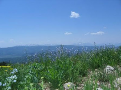
Our destination was Pole Creek Sink. We rode mostly on the road, giving Daisy a swim and the horses a drink when we first crossed Pole Creek after about 3 miles. The ride went through the Neola fire burn area, although the burned spots are patchy. Where the trees are blackened and dead, the grass is lush with wildflowers and new life. Grass grew over 2 feet high, columbines were in bloom, and we saw nice displays of lupine, mountain bluebells, and a whole area covered with western bistort.
We also noticed areas among the aspens where the ground was covered with what looked like cotton. We assume this cotton-like substance contains aspen seeds.
The sink was amazing. A couple of caves were above the water level, apparently where water used to go through when the level was higher. Now there is a deep pool into which much of the water flows for a tour underground. Above the sink, 3 branches of the creek cascade downward, joining as they enter the sink.
On the way back, we took a side path up Big Bend Hollow, adding a few hundred foot climb to the ride. The sky was turning progressively darker, with lightning and thunder in the distance.
Instead of following the road home, we rode mostly off the beaten path in the cover of aspen trees, where we found a series of beaver ponds we had missed on the way up. The creek (apparently fed to aboveground life again by springs below the sink) slowed as it went through these pools. One of a beaver pond’s functions is to hold the water so it can soak into the ground, nourishing the adjacent trees and flora.
We passed a campfire ring where campers had neatly thrown their beer cans and used shotgun shells, and another where campers had emptied the ring, throwing the empty glass cans and bottles outside the ring. Perhaps both groups were just trying to be environmentally correct. the first ones didn't leave their trash lying around. The second group thought leaving stuff in the campfire ring was tacky, so they just threw it out. Uhmm, okay. I guess both are acceptable in redneck camping etiquette.
In spite of the ominous-looking sky, we only felt a few raindrops.
We found a few thistle plants near the trailer for a special treat. Mischief and Boss bare their teeth to avoid the pricking their lips and just nip off the flowers. Strangely enough, they seem to favor thistle blooms, even over grass.
The ride was an easy 8.5 miles, about 1200 feet elevation gain.